Show the map
Ca pique avec Guigui
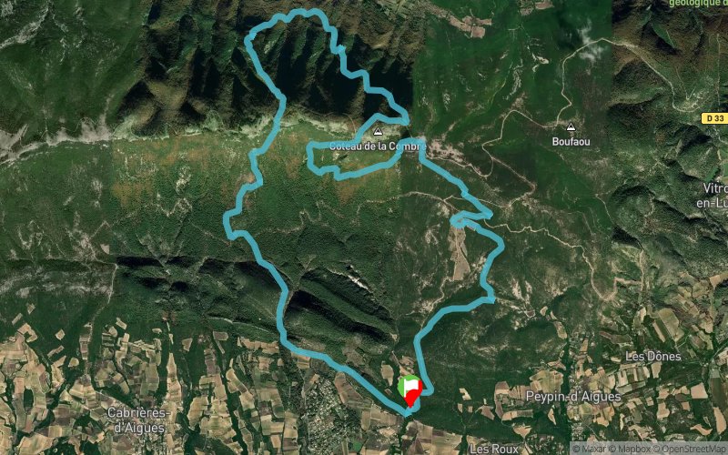


21.7 km
1440 m
1440 m
 Saint-Martin-de-la-Brasque (84)
 Points of Interest table
| Accum. | Intermediary | |||||||
|---|---|---|---|---|---|---|---|---|
| POI | Description | Alt. | Dist. | D+ | D- | Dist. | D+ | D- |
Trace n°251535
Ascent threshold : 3 m Distance threshold : 30 m Smoothing : Yes Origin of altitudes : MNT Aster GDEM
Ascent threshold : 3 m Distance threshold : 30 m Smoothing : Yes Origin of altitudes : MNT Aster GDEM
Loop
Dominant terrain : Footpath
Max alti. : 1010 m
Avg alti. : 690 m
Min alti. : 411 m
Longest ascent : 550 m
Longest descent : 620 m
Route completed by the author : Yes
Dominant terrain : Footpath
Max alti. : 1010 m
Avg alti. : 690 m
Min alti. : 411 m
Longest ascent : 550 m
Longest descent : 620 m
Route completed by the author : Yes
Elevation profile
More tools
Create a new roadbook page
Map and track on your website
Warning ! When you insert a Trace de Trail map on your website, you agree not to hide any element of the module (links to Trail Trail or Trail Connect banner)
Add a realisation
Validate
Add a realisation to share your chrono and describe the conditions that you encountered during you trail running !
Add a comment
Validate
Quentin_69
24/03/24, 20:07:26
Super tracé. Les sentiers sont très techniques. Il y a une belle vue tout le long du parcours.
24/03/24, 20:07:26
Super tracé. Les sentiers sont très techniques. Il y a une belle vue tout le long du parcours.
Show the infos
Add a track


